
UPDATED HURRICANE MILTON WILL HIT TAMPA AS A CATEGORY 4 STORM
Massive evacuations are underway.

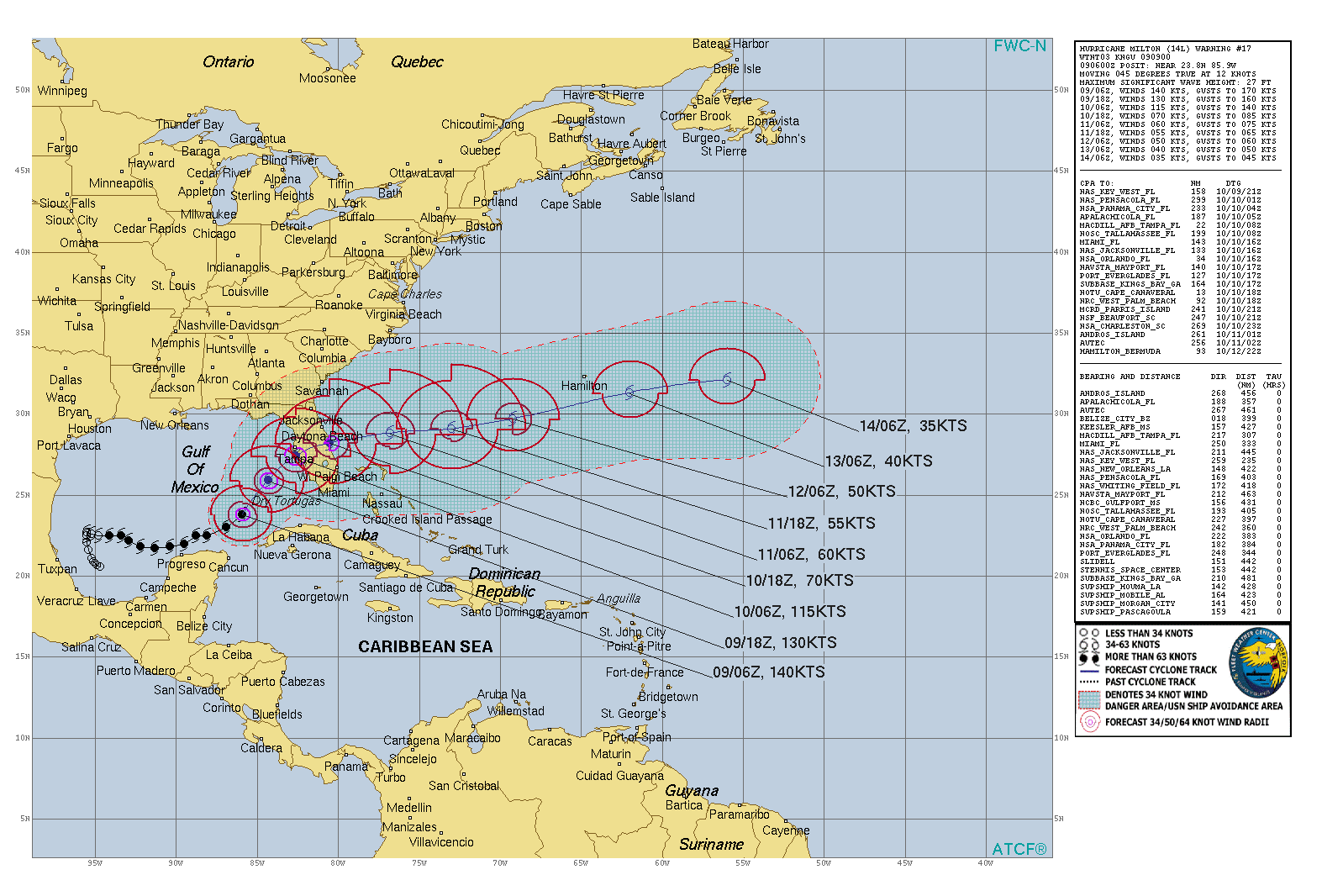
This is the U.S. Navy / National Research Lab present forecast track for Hurricane Milton as of the morning of 10/9/24. It is now forecast to hit Tampa as a CATEGORY FOUR storm around daybreak tomorrow — but the effects will begin around midnight.
RIGHT NOW Milton has sustained winds in the Category 5 range, but is expected to weaken to a high category 3 or low category 4 by landfall. AND a few good things might happen: another eyewall replacement, increasing shear in the trough ahead of it, or the ingestion of colder air aloft. All could weaken the storm. But nobody can count on that.
NOTE: When you look at this map, wind speeds are in knots. To find mph, multiple the wind speed in knots x 1.151 to get the miles per hours.
ASK your local public safety people where to go. You must get away from the storm surge on the Gulf Coast.
STORM SURGE:
The storm surge on the Gulf Coast can be as high as 12’ above ground level if Milton comes in at high tide. This contrasts with Helene, where the storm was no more than 8’ above ground level at high tide.
Yes, this is worse.
FOLLOW THE INSTRUCTIONS GIVEN BY LOCAL OFFICIALS. AT SOME POINT THEY WILL STOP YOU FROM LEAVING SO YOU DON’T GET TRAPPED ON THE ROADS.
We’ll update again later in the day.
My heart breaks for the sick, the poor and the elderly. The rescue crews are phenomenal.