
Hurricane Helene Will Landfall as a Cat 4: Get out NOW.
If you live in the Big Bend area of Florida, EVACUATE NOW.

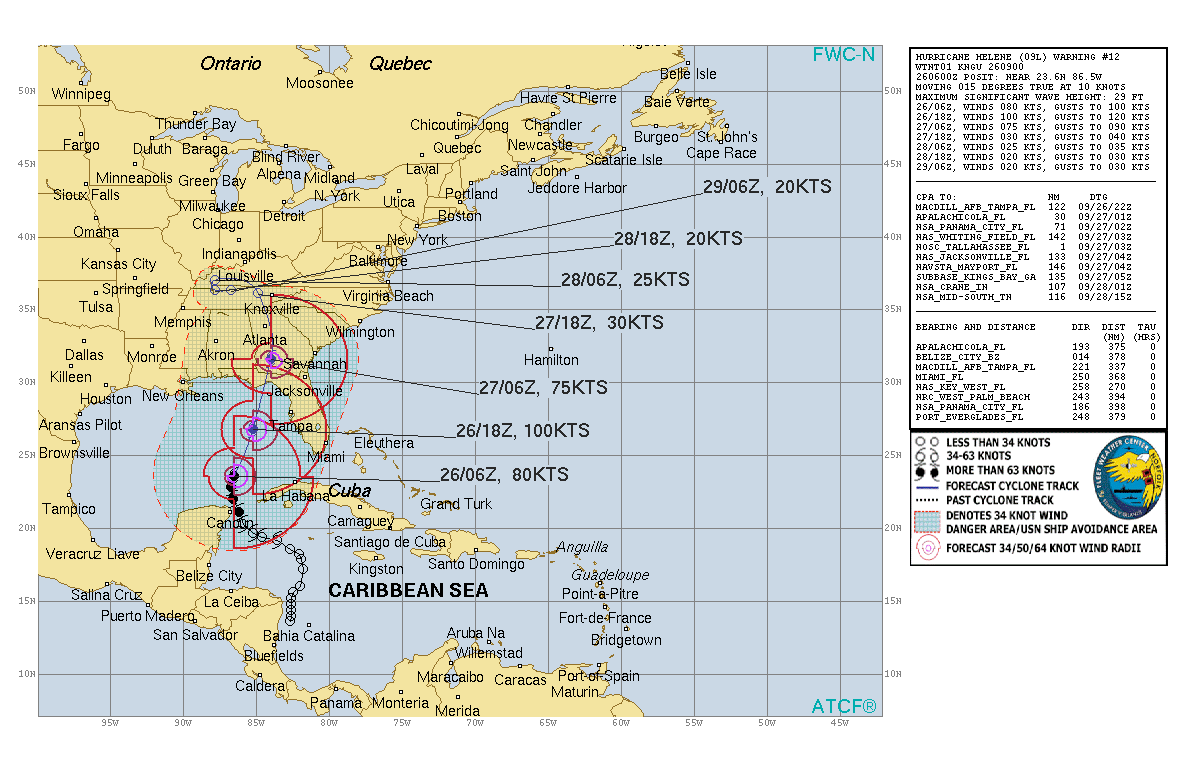
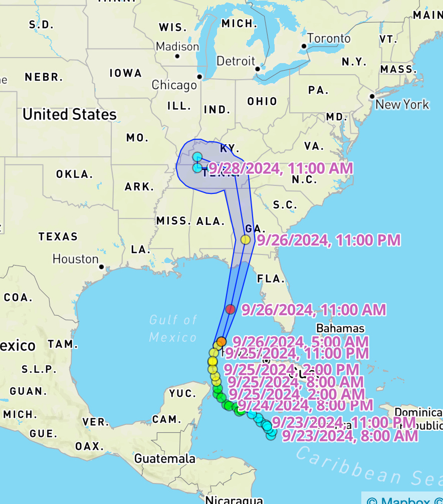
HEADS UP!!!!!!! Here is the U.S. Navy’s track for Hurricane Helene. Note that the wind cones bulge on the RIGHT side of the storm — which they always do in the Northern Hemisphere — and how the intense this storm is going to be for Florida. Also, hurricanes that landfall from the Gulf carry more tornadoes than Atlantic land-falling storms do—more instability in the atmosphere to begin with—so there will potentially be even more damage than there would have been had the storm come in from the cooler-water ocean side. THE STORM WILL LANDFALL AT 11:00 P.M. EASTERN TIME —and hurricane winds can begin as much as three hours ahead of landfall. …
The storm is PRESENTLY anticipated to landfall as a Category IV storm with winds up to 155 mph and a storm surge of 13-18 feet above normal tide.
Also note that one of two things often happens just before landfall:
Either there is an eye wall replacement cycle that drops the intensity of the storm as the confrontation between land and water wind levels shears the storm or
The storm SUDDENLY intensifies, as it did in Hurricane Camille with disastrous results.
To those in the storm’s path, finish hurricane preparations this morning and GET OUT. The only happy thing here is that the storm will landfall only about two hours after low tide. But it’s so dangerous, you just can’t be there.
Do not, please, think you can stay. Don’t do that to yourself. Earth won’t be nearly as much fun if you’re not here.
"Earth won’t be nearly as much fun if you’re not here." Lovely!